In the past few days I’ve been working up a new post for my other blog Senchus. I’ll be looking at a controversial topic: the famous battle of Brunanburh, fought in AD 937 at an unidentified location somewhere in what is now northern England. The victor at Brunanburh was Athelstan, king of the English, a grandson of Alfred the Great. The leaders on the losing side were King Anlaf (‘Olaf’) of Dublin, King Constantin of Alba (Scotland) and King Owain of Strathclyde. In the blogpost I’ll calculate the distances travelled by the respective armies to a couple of places suggested as the site of the battle, and then mark the routes on a map. I’ll take the starting-point for each army as the leader’s principal centre of power or ‘royal capital’.
The map below represents an early stage in the exercise. It shows the ‘capitals’ of the main protagonists in the Brunanburh campaign: Winchester, chief power centre of the West Saxon dynasty who ruled most of Anglo-Saxon England in the tenth century; Dublin, headquarters of the most powerful Viking kingdom in the British Isles; Scone, home of the Gaelic-speaking kings of Alba; and Govan, the royal capital of Strathclyde. Two other places are also shown: York, the great stronghold of Anglo-Scandinavian Northumbria; and Bamburgh, an ancient coastal fortress in Bernicia (the northern part of Northumbria) held by a hereditary line of English lords.
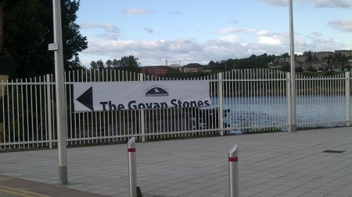
Each of these places was a hub of political authority and military strength, and each played a role – directly or indirectly – in the sequence of events leading up to the Brunanburh campaign. Five of the six – Winchester, Dublin, York, Scone and Govan – were the most important centres of power in tenth-century Britain and Ireland. Govan’s membership of this elite quintet has frequently been overlooked but cannot be denied. Sculpture and archaeology confirm its status as one of the major royal capitals of the Viking Age.
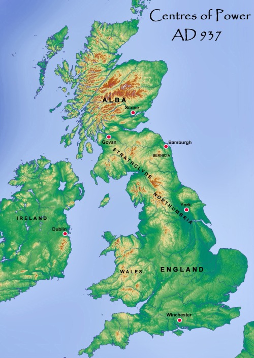
Original topographic map by Equestenebrarum via Wikimedia Commons.
* * * * * * *


")
